
Patricia Murrieta Flores
- Position
- Postgraduate Research Student
- Institution
- Humanities (FH)
- Webpage
- http://patriciamurrieta.wordpress.com/some-publications/
- Contact
- Complete this online contact form to contact Patricia.
I'm a Mexican archaeologist. I studied at the National School of Anthropology and History in Mexico City. During my undergraduate studies I was granted with a SEDESOL scholarship. I graduated with Honours and my dissertation was recommended for publication. I worked for the National Institute of Anthropology and History (INAH) for several years, I was head of the cartography unit of the INAH-Chiapas Centre and I developed several projects within the National Coordination of Archaeology. I continued my studies at the University of Southampton receiving a Master of Science in Archaeological Computing (Spatial Technologies) in 2007. My studies were supported by the National Council of Science and Technology of Mexico (CONACYT) and I graduated with distinction.
I'm now a PhD student at the University of Southampton supported by CONACYT. My research is focused on the development of new theories and methodologies using spatial analysis and innovative computational techniques to understand human movement and travelling during prehistoric times. Although my main research is concerned with prehistory, I'm is involved in several projects looking at the mobility of Late Antique societies in the Balearic Islands and the history and archaeology of Sugar Cane Haciendas in Mexico.
As a member of the Archaeological Computing Research Group (ACRG) I have presented my work in several international conferences and I have has also published several articles.
I am currently working in the theory and implementation of Cost Surface Analyses, using Geographic Information Systems to evaluate the patterns of movement of the pastoral societies of Western Sierra Morena (Andalucia, Spain) during the Chalcolithic and Bronze Age.
Projects

Gallery
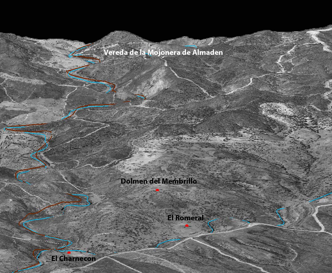
Transhumance Route and some Megalithic Monuments of Sierra Morena.
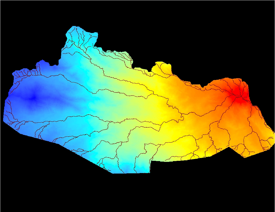
Example of Cost Surface and the Least Cost Path derived in Western Sierra Morena.

This map shows the most accesible areas of transit (red) in the Majorcan landscape.
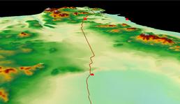
Simulated path for Late Antiquity in Majorca, Spain.