Seminar 5th October 2015 10 a.m. Boldrewood Campus B176 Room 2013
Reproducibility in Satellite Imaging Research
Robin Wilson
University of Southampton
- Categories
- NGCM
- Submitter
- Susanne Ufermann Fangohr
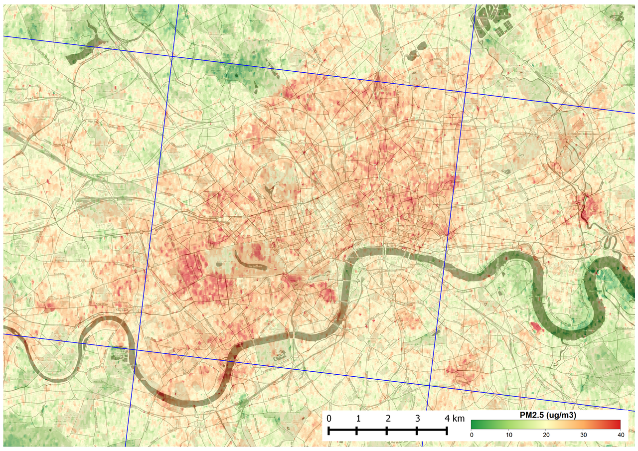
A map of particulate matter pollution over London, produced from satellite data using the HOTBAR algorithm.
Summary
Data derived from satellite images are becoming absolutely essential in a range of fields, from climate change and agriculture to pollution monitoring and geological exploration. It is therefore essential that the results of satellite image processing algorithms are accurate. This presentation will give a brief introduction to satellite imaging and the general processing steps, before describing Dr Wilson’s ‘journey’ around the importance of reproducibility in this work. The talk will finish with a practical demonstration of recipy, a tool that has recently been developed by Dr Wilson that aims to improve reproducibility and provenance tracking with very little effort from the user.
Biography
Dr Robin Wilson gained his PhD from the University of Southampton in 2015, and is currently a Research Fellow in Geography & Environment at Southampton. His PhD focused on the development of a novel method to obtain high-resolution air pollution measurements from satellite imagery. This method, known as HOTBAR, produces data with over 100,000 times more detail than previous methods, with a similar level of accuracy. Before his PhD, Robin developed safety and control software for nuclear power stations, and developed his programming expertise throughout his PHD, which involved significant software development work. As well as his satellite imaging work, Robin is a Fellow of the Software Sustainability Institute, and has created and contributed to a range of open-source software.